


Russell Voting District, Clarke County, Virginia
About
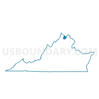
Outline

Summary
| Unique Area Identifier | 681358 |
| Name | Russell Voting District |
| County | Clarke County |
| State | Virginia |
| Area (square miles) | 39.41 |
| Land Area (square miles) | 39.28 |
| Water Area (square miles) | 0.13 |
| % of Land Area | 99.66 |
| % of Water Area | 0.34 |
| Latitude of the Internal Point | 39.19127630 |
| Longtitude of the Internal Point | -78.02049140 |
Maps


Graphs
Select a template below for downloading or customizing gragh for Russell Voting District, Clarke County, Virginia


Neighbors
Neighoring Voting District (by Name) Neighboring Voting District on the Map
- Voting District 20, Jefferson County, WV
- Voting District 22, Jefferson County, WV
- Voting District 25, Jefferson County, WV
- Voting District 32, Berkeley County, WV
- Berryville Voting District, Clarke County, VA
- Buckmarsh Voting District, Clarke County, VA
- Clear Brook Voting District, Frederick County, VA
- Greenwood Voting District, Frederick County, VA
- Millwood Voting District, Clarke County, VA
- Neffs Town Voting District, Frederick County, VA
- White Post Voting District, Clarke County, VA
Top 10 Neighboring County Subdivision (by Population) Neighboring County Subdivision on the Map
- Shenandoah district, Berkeley County, WV (21,115)
- Stonewall district, Frederick County, VA (13,101)
- Red Bud district, Frederick County, VA (12,809)
- Kabletown district, Jefferson County, WV (12,271)
- Middleway district, Jefferson County, WV (9,353)
- Berryville district, Clarke County, VA (3,343)
- Buckmarsh district, Clarke County, VA (2,864)
- Millwood district, Clarke County, VA (2,624)
- White Post district, Clarke County, VA (2,616)
- Russell district, Clarke County, VA (2,587)
Top 10 Neighboring Place (by Population) Neighboring Place on the Map
Top 10 Neighboring Unified School District (by Population) Neighboring Unified School District on the Map
- Berkeley County School District, WV (104,169)
- Frederick County Public Schools, VA (78,305)
- Jefferson County School District, WV (53,498)
- Clarke County Public Schools, VA (14,034)
Top 10 Neighboring State Legislative District Lower Chamber (by Population) Neighboring State Legislative District Lower Chamber on the Map
- State House District 33, VA (113,100)
- State House District 29, VA (88,049)
- State House District 56, WV (25,419)
- State House District 53, WV (24,082)
- State House District 58, WV (21,829)
Top 10 Neighboring State Legislative District Upper Chamber (by Population) Neighboring State Legislative District Upper Chamber on the Map
Top 10 Neighboring 111th Congressional District (by Population) Neighboring 111th Congressional District on the Map
Top 10 Neighboring Census Tract (by Population) Neighboring Census Tract on the Map
- Census Tract 510, Frederick County, VA (9,391)
- Census Tract 101, Clarke County, VA (8,318)
- Census Tract 511.01, Frederick County, VA (7,105)
- Census Tract 9728, Jefferson County, WV (6,061)
- Census Tract 9721.01, Berkeley County, WV (4,924)
- Census Tract 501, Frederick County, VA (4,089)
- Census Tract 102, Clarke County, VA (3,055)
Top 10 Neighboring 5-Digit ZIP Code Tabulation Area (by Population) Neighboring 5-Digit ZIP Code Tabulation Area on the Map
- 22602, VA (28,443)
- 25414, WV (17,024)
- 22611, VA (8,757)
- 25430, WV (8,112)
- 25413, WV (7,508)
- 22624, VA (2,565)
- 22656, VA (2,381)
- 22620, VA (2,348)
- 25446, WV (1,463)